Expert for
Large Wood & Blockage Risk
Expert analysis and customised protection strategies for authorities, infrastructure, and the private sector – robust decision-making approaches for climate-adapted flood protection.
Smart Solutions for the Environment
Spreitzer Engineering Consulting for Wood Dynamics & River Engineering
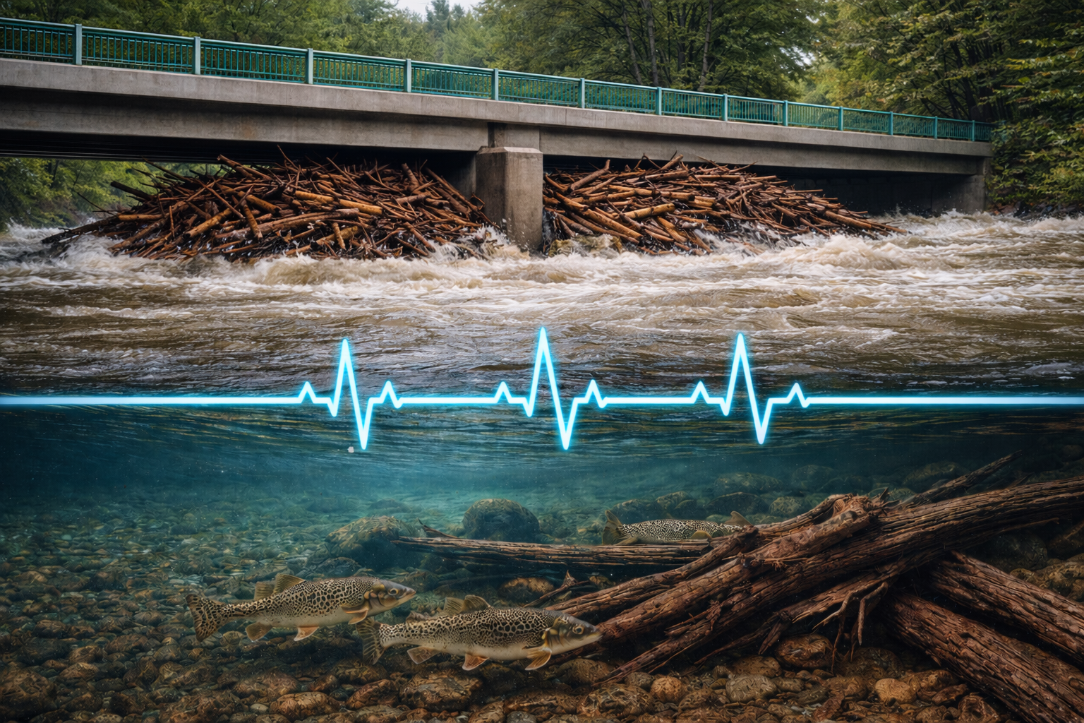
When large wood becomes a risk...
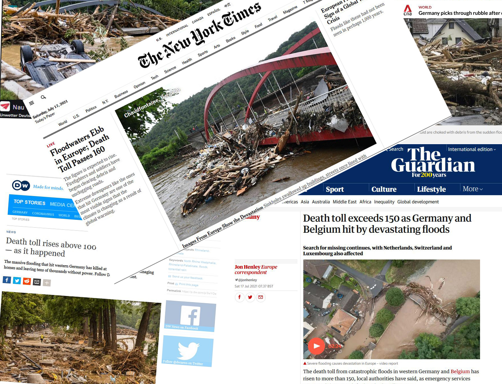
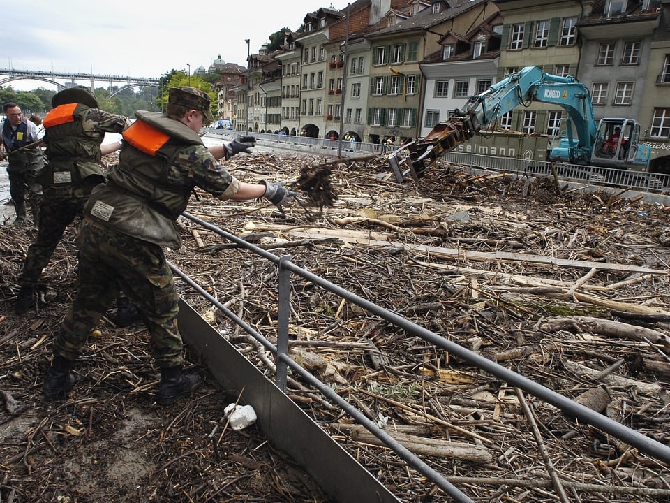
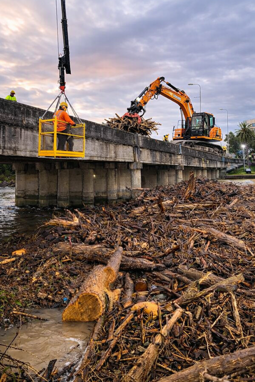
Large wood blockages are among the most frequent causes of unexpected flooding and damage during high water events. Reliable quantification and proactive measures directly in the catchment area (at the source) create planning security – from risk assessment to the design of protective measures.
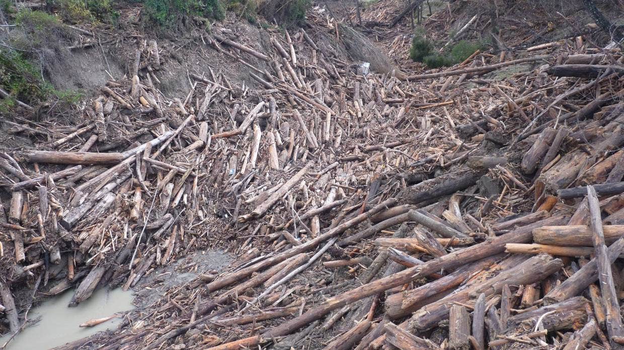
What is large wood?
What is large wood?
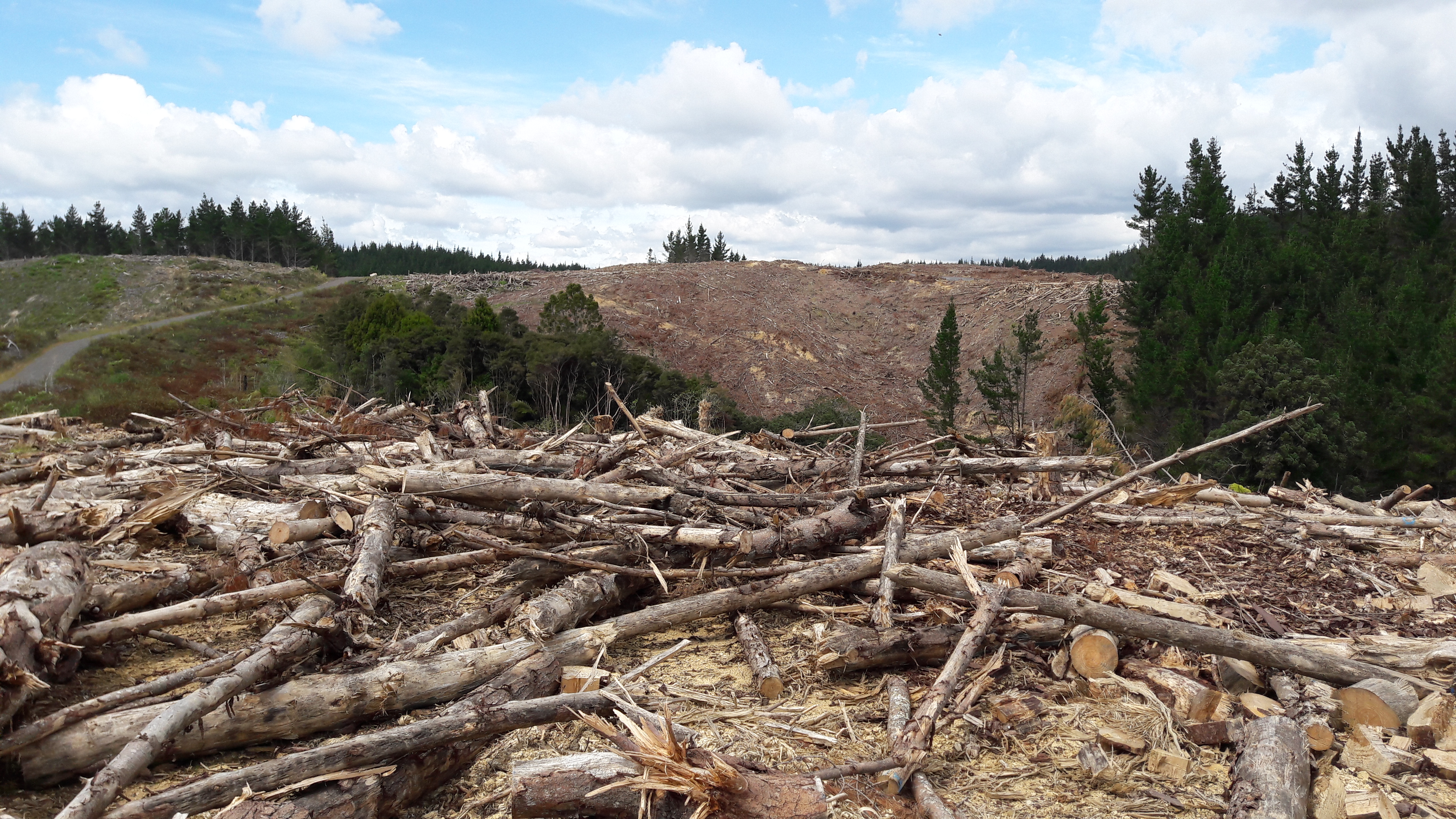
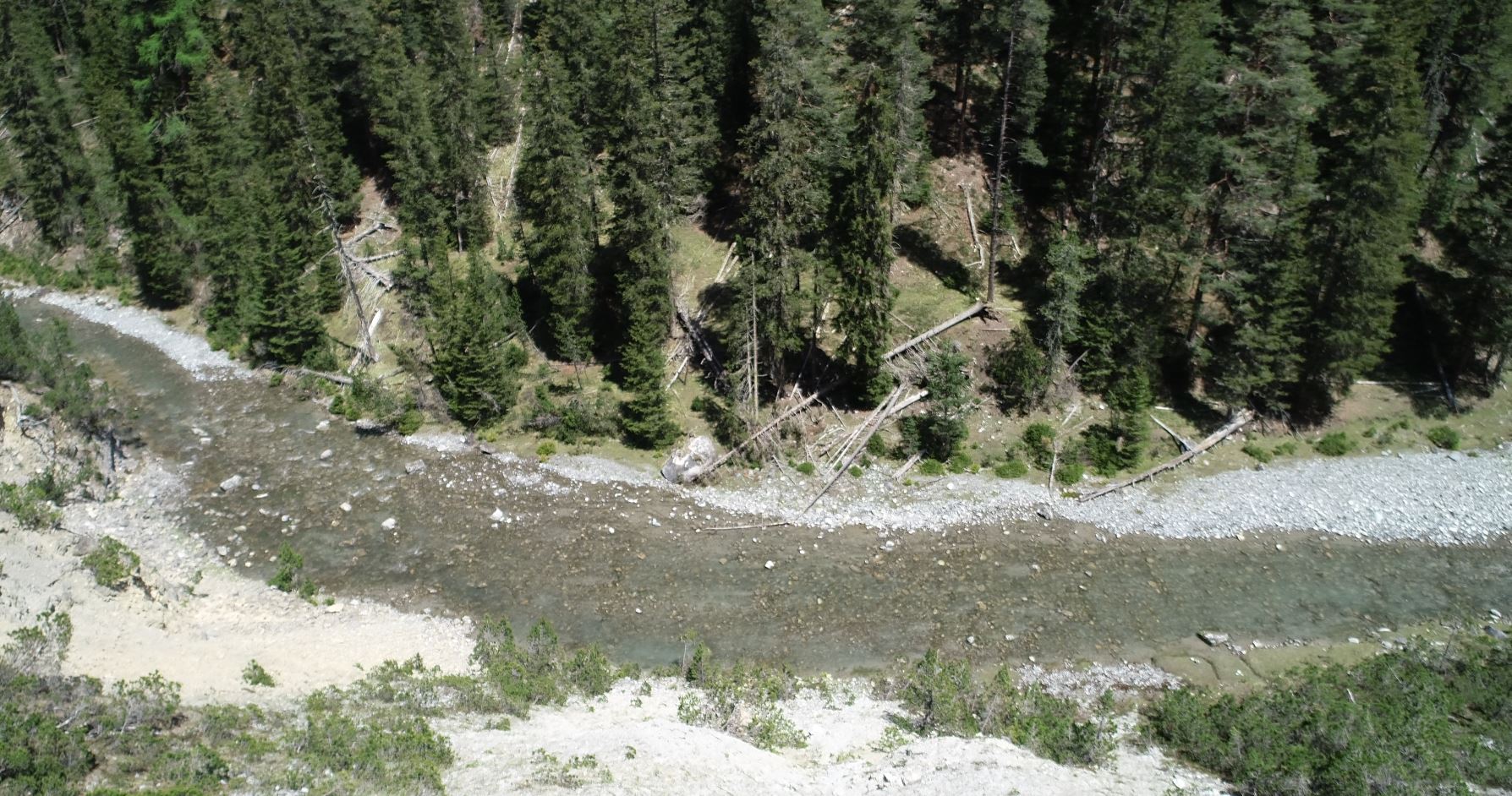
Large wood (or driftwood) fulfills important ecological and hydraulic functions in running waters. Deadwood creates structurally rich habitats, improves river morphology, promotes biodiversity, and contributes to stabilizing the riverbed. In addition, it can positively influence flow dynamics by creating flow diversity and supporting sedimentation processes.
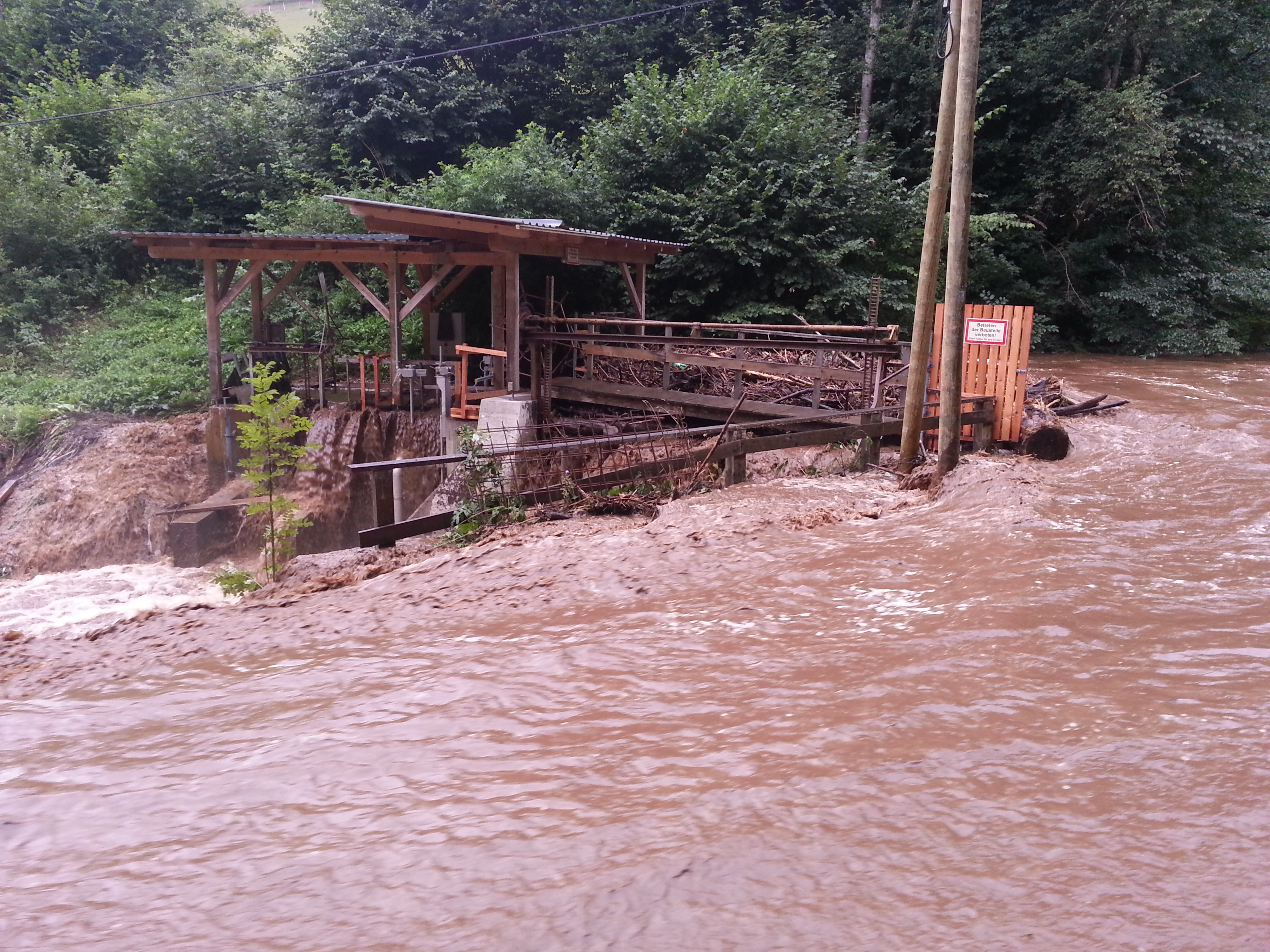
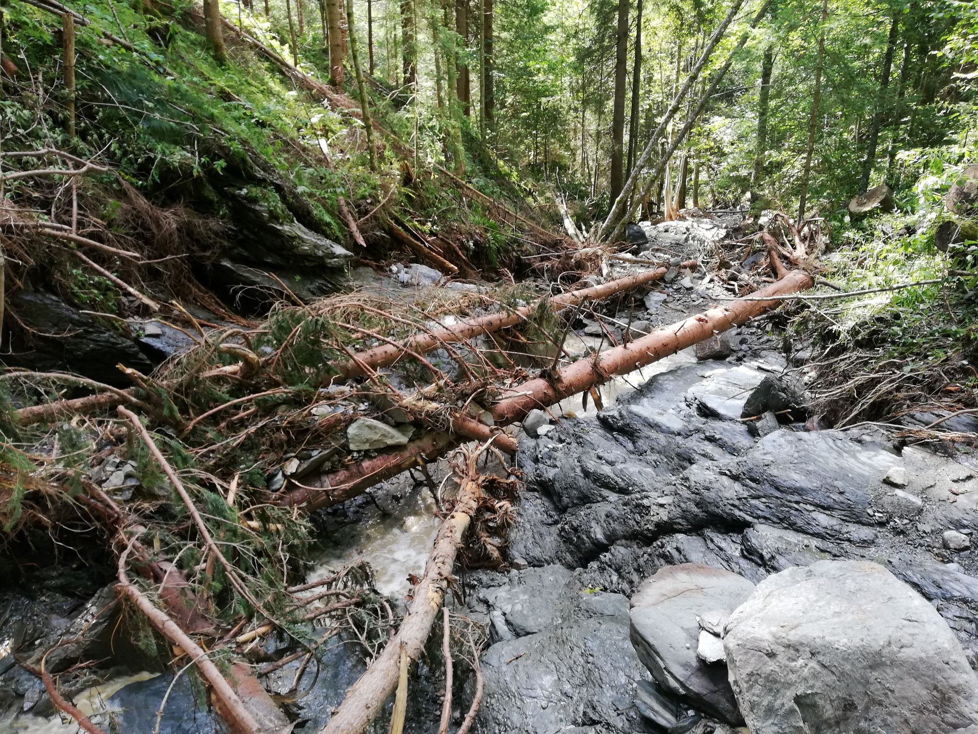
During a flood, however, this exact natural element can become a significant hazard.
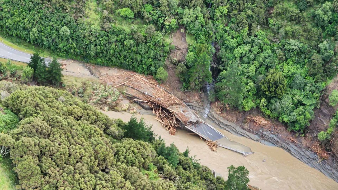
Why does large wood become problematic during floods?
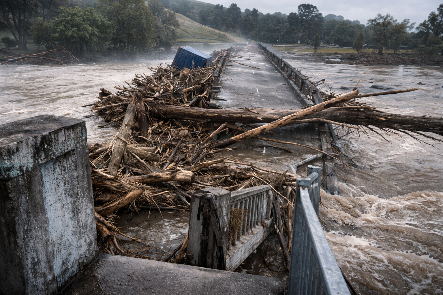
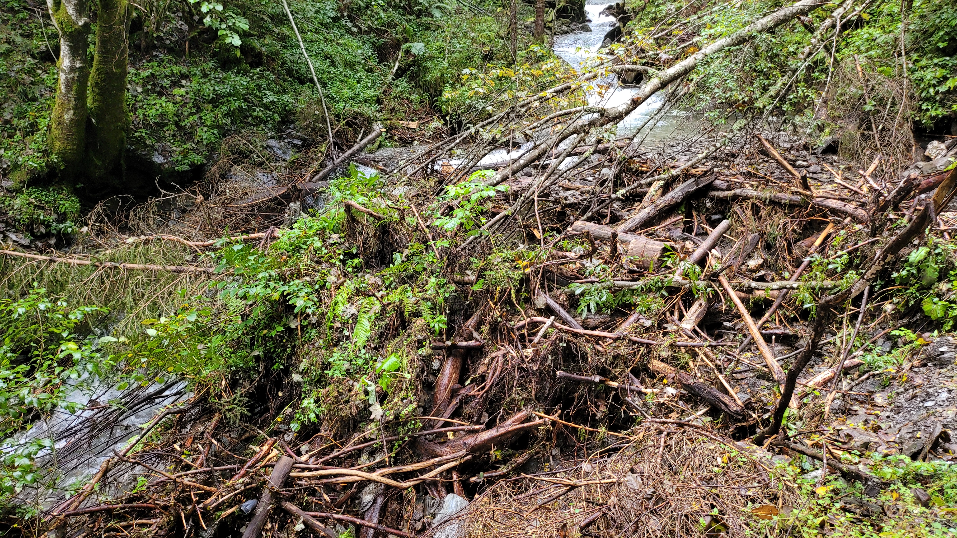
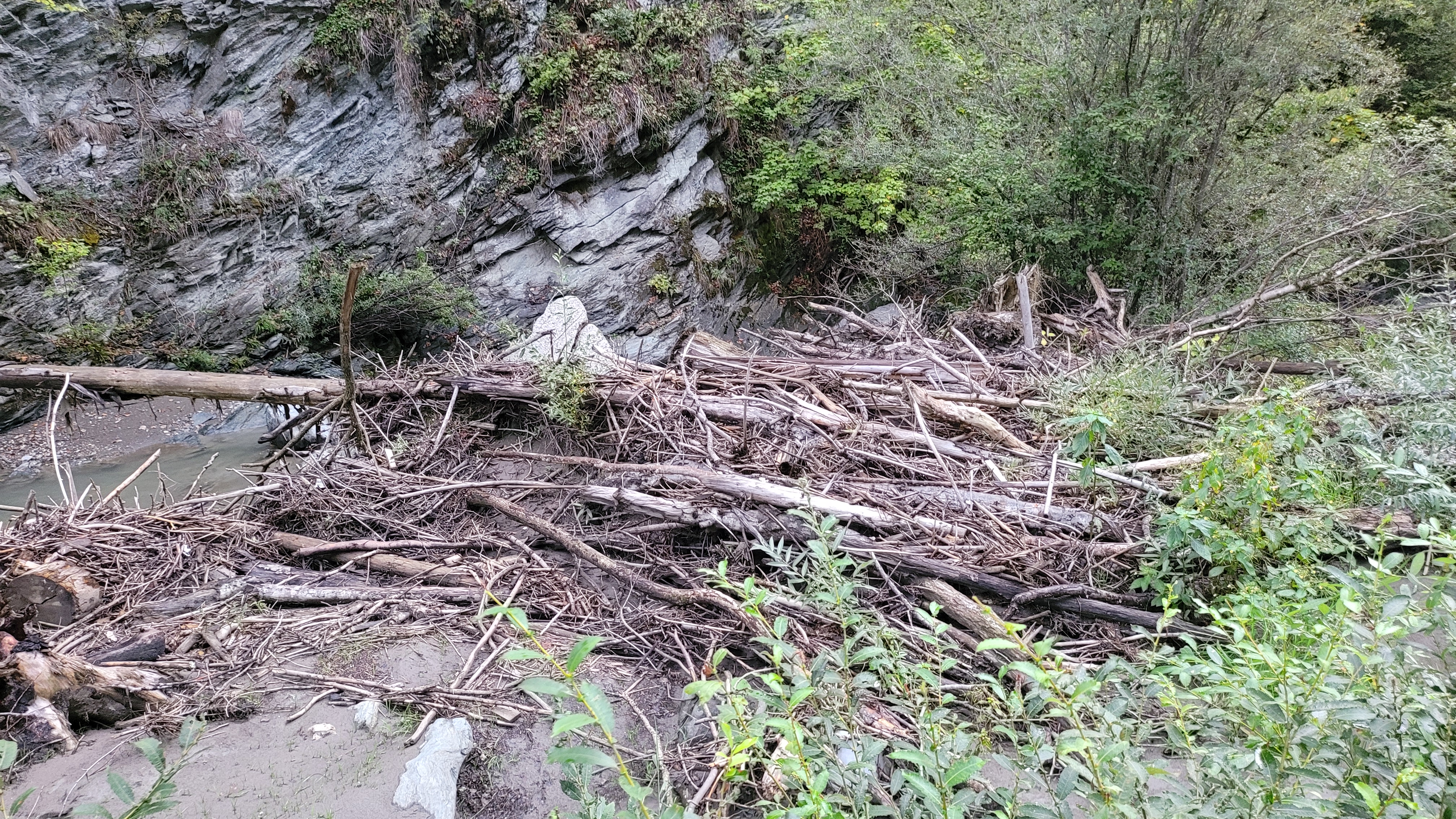
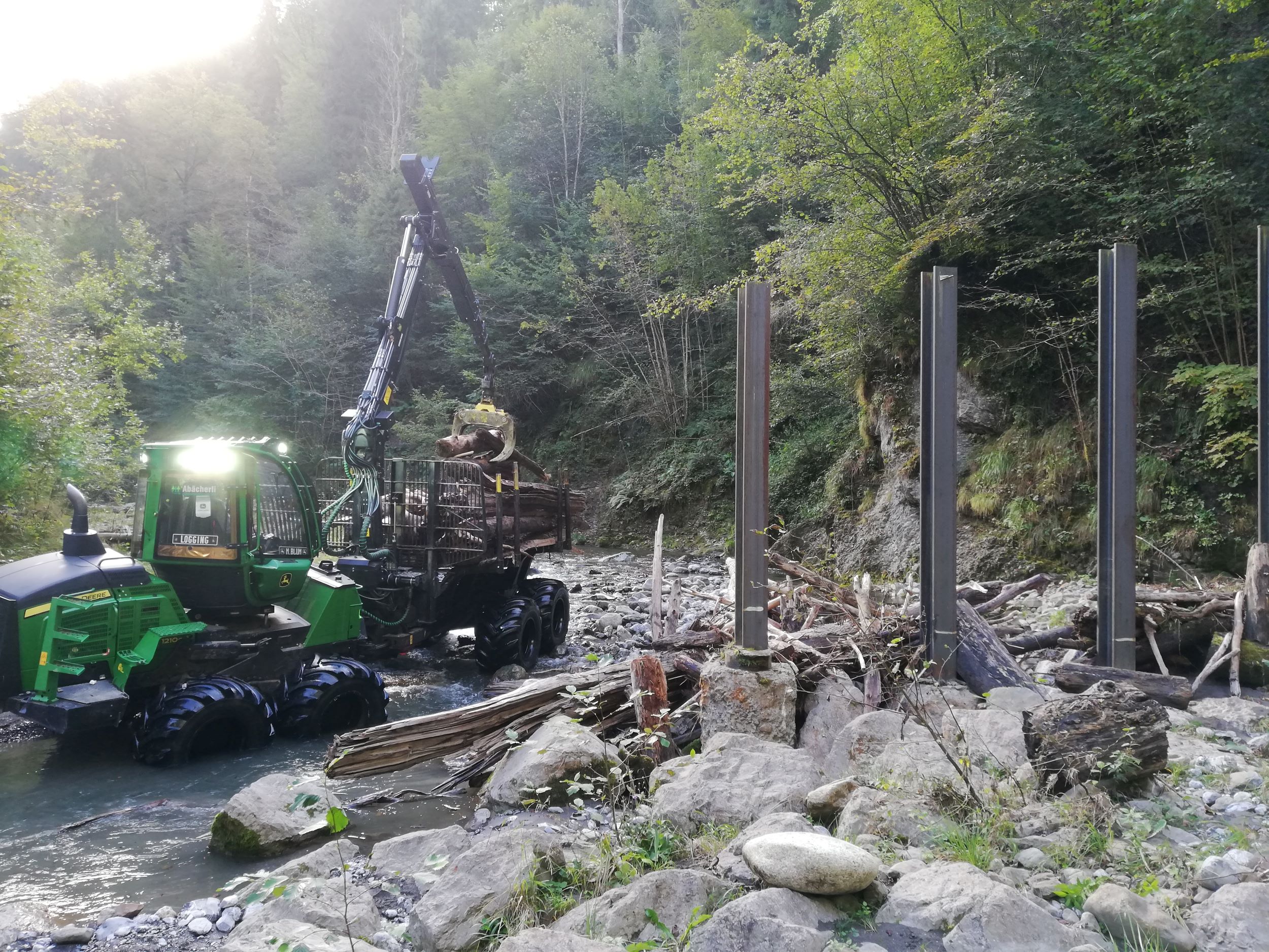
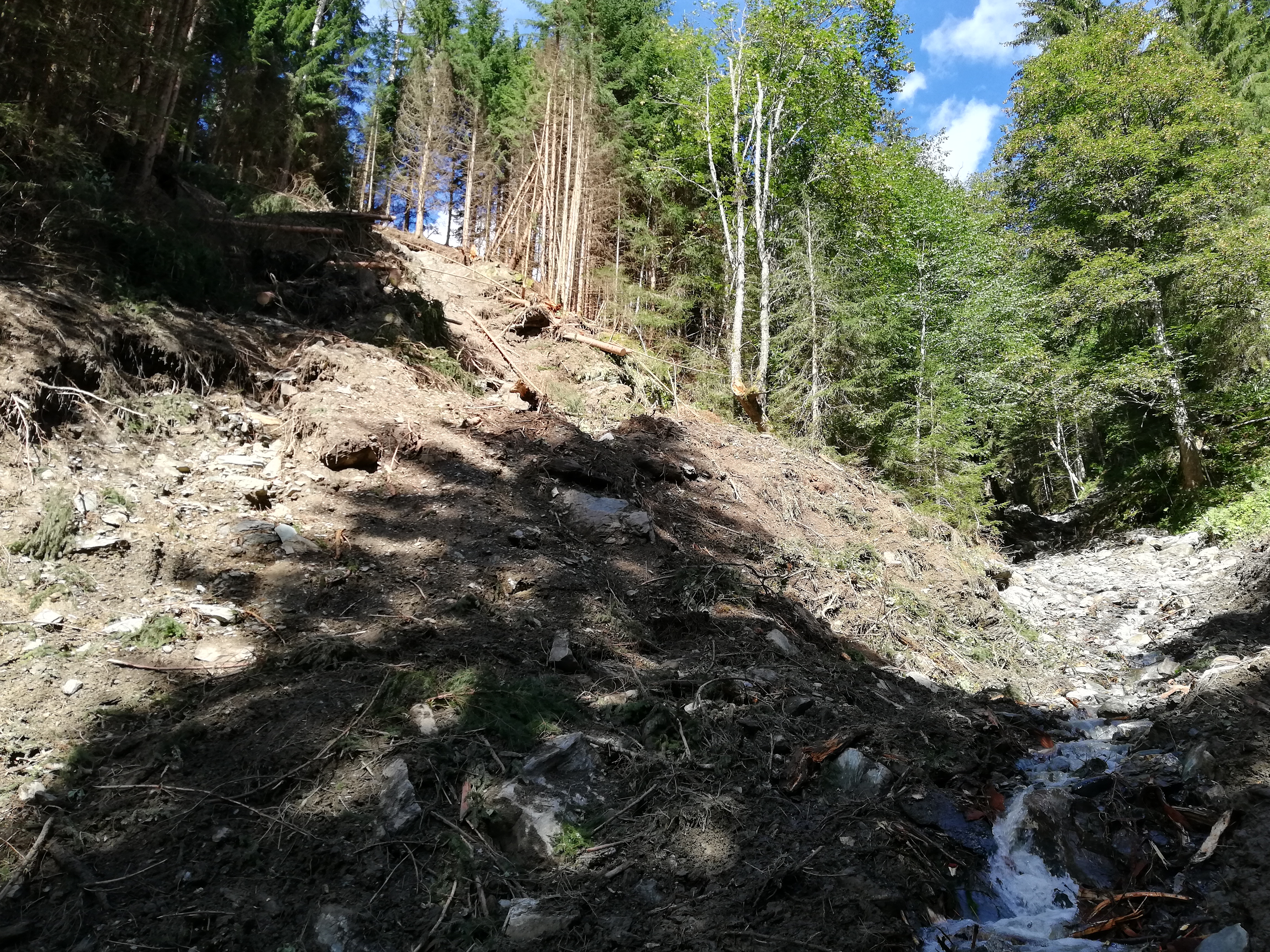
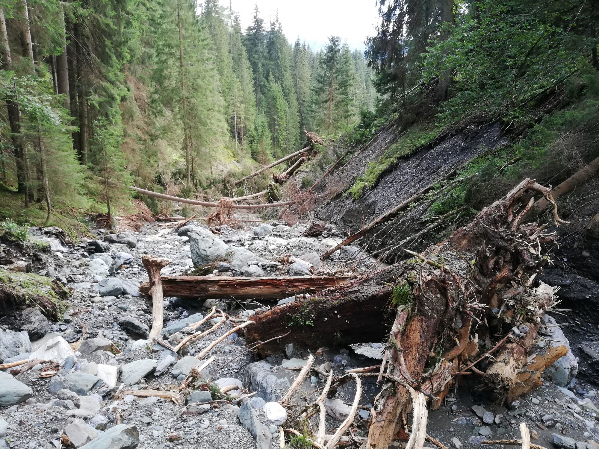
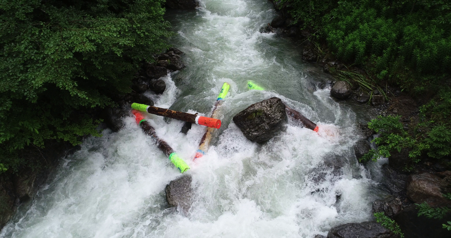
During heavy rainfall and floods, wood is mobilized from riparian zones and the catchment area, and transported downstream with high dynamics. At bridges, culverts, or bottlenecks, it can accumulate in a short period of time and form massive logjam blockages.
The consequences can be severe:
- Rapid backwater effects and unexpectedly rising water levels
- Flooding of settlement and infrastructure areas
- Significant additional structural loads on buildings
- Sudden discharge waves in case of a sudden blockage failure
Such developments often occur at short notice and with high dynamics - especially where the large wood potential was not systematically evaluated in advance.
Why precaution is crucial
Large wood risks do not arise by chance. They are the result of the catchment area, watercourse structure, and building constellation. If these relationships are not analyzed early on, even well-dimensioned protective structures can reach their limits.
A forward-looking assessment of large wood potential is therefore not an add-on, but an essential safety factor for communities and critical infrastructure.
Conclusion
Large wood is ecologically valuable – but potentially exacerbates damage in the event of a flood. Without a sound risk analysis, blockages can lead to considerable economic damage within a very short time.
Spreitzer Engineering Consulting supports the systematic assessment of large wood risks and develops robust strategies to minimize potential hazards – before a natural element becomes a safety-relevant problem.


... what is needed:
Risk analysis and potential assessment
Systematic assessment of large wood potential in the catchment area as well as identification of sensitive areas with an increased risk of blockage. The goal is to identify potential hazards early on and realistically assess them.
Targeted protection strategies
Consideration of potential large wood effects in the planning and conception of hydraulic engineering facilities in order to effectively minimize risks for structures and settlement areas.
Operation and precautionary management
Continuous observation of critical sections as well as coordinated precautionary strategies increase operational safety and reduce the damage potential in the event of an incident. An integrative driftwood management connects safety requirements with ecological objectives.
Prevent floods before they arise
Flood protection begins in the catchment area, by delaying precipitation water directly at its source through targeted retention and infiltration, thereby effectively reducing the load on downstream watercourse systems.
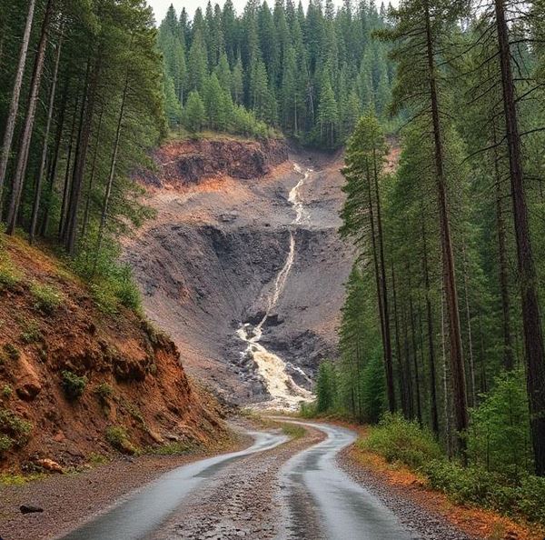
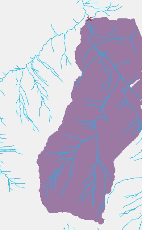
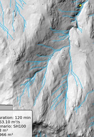
Flood protection begins in the catchment area
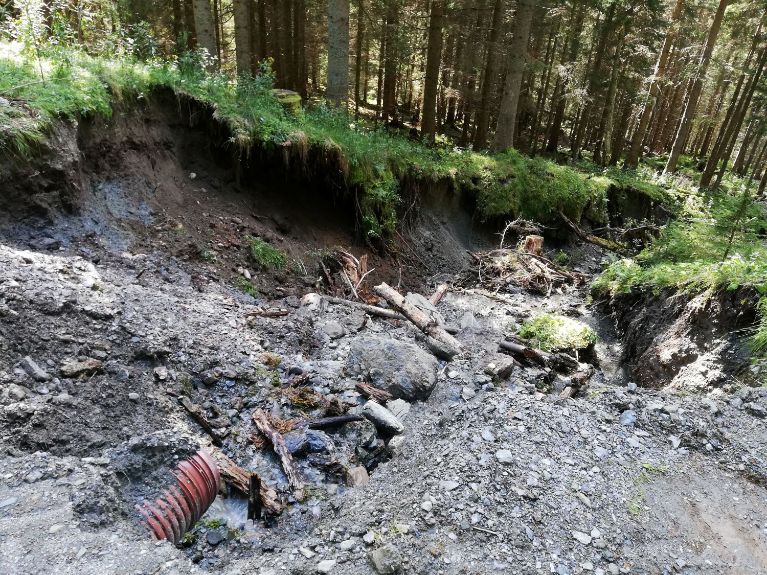
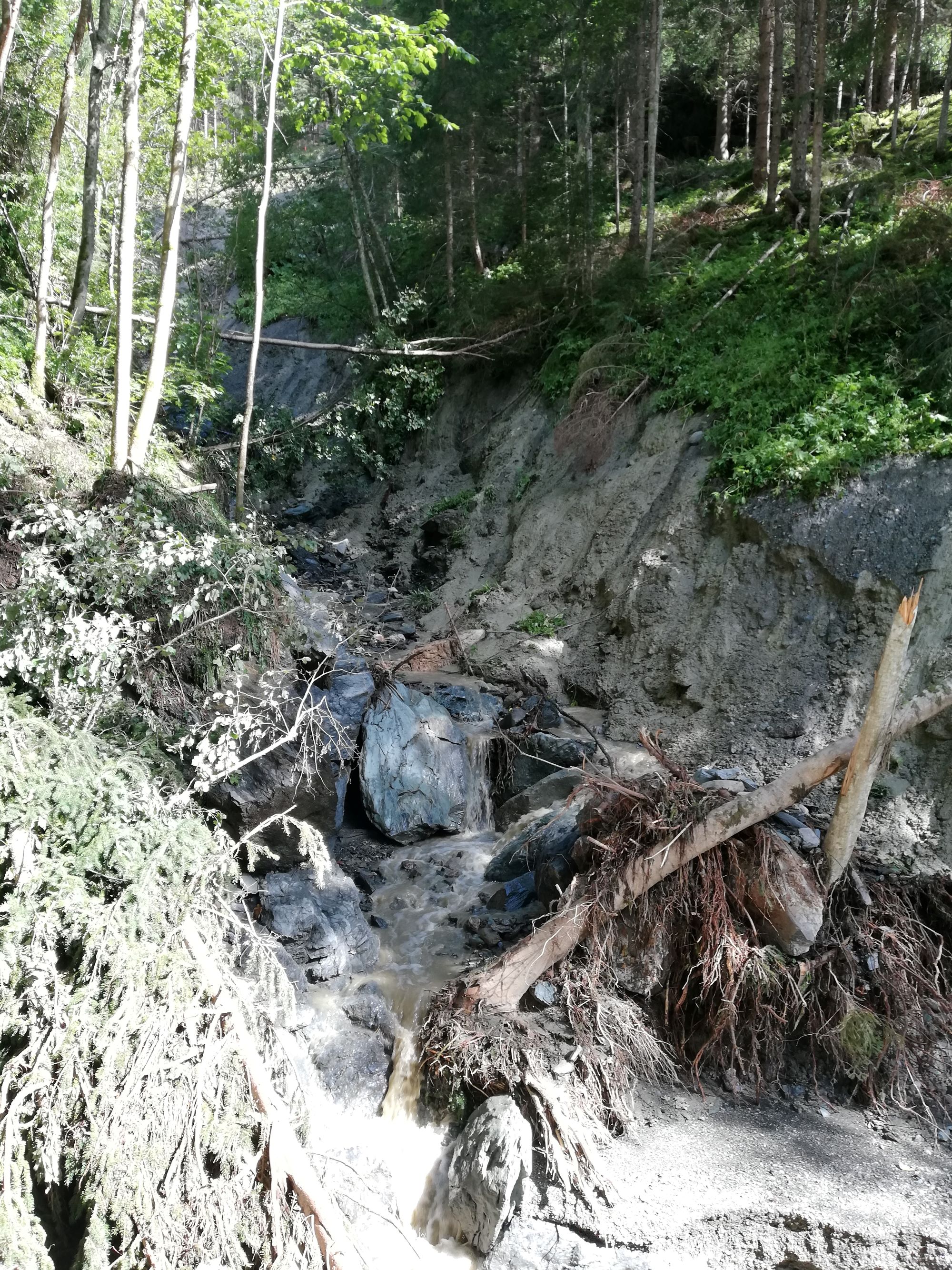
Flooding does not just start in the watercourse – but in the catchment area. Where precipitation hits the soil and runoff processes develop, the course is set for subsequent loads.
Forward-looking flood precaution therefore starts early: Through targeted measures in the catchment area, runoff peaks can be effectively reduced and downstream watercourse as well as infrastructure systems can be sustainably relieved.
The decisive factor here is not a single measure, but the coordinated interaction of many factors across the entire catchment area. In particular, micro-scale measures - i.e., small-scale, decentralized solutions - develop a noticeable effect on the overall system when properly designed.
This is exactly where an integral perspective comes in:
Only those who holistically analyze runoff dynamics, terrain, land use, and hydraulic relationships can develop effective and economically sensible prevention strategies.
Spreitzer Engineering Consulting accompanies authorities, infrastructure operators, professional associations, and landowners in the sound assessment of their catchment area and develops tailor-made concepts for sustainable flood prevention - forward-looking, systemic, and geared towards long-term safety.
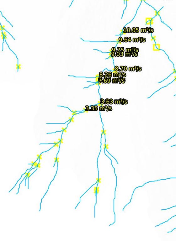
Analysis of catchment area and runoff processes
Topography, land use, and natural boundary conditions significantly determine how precipitation transforms into runoff. Only a systematic analysis of these relationships makes it possible to identify risks early on and derive robust prevention strategies.
Decentralized retention and promotion of infiltration
Sustainable flood protection relies on retention and infiltration at the source. Decentralized measures in the catchment area help to reduce runoff peaks and relieve downstream watercourse and infrastructure systems. Potential large wood should also be considered early on and – where necessary – controlled and retained to minimize later risks.
Integrated implementation and participation of all stakeholders
An effective protection concept is not created by individual measures, but by coordinated action across the entire catchment area. Communities, infrastructure operators, and landowners all make a decisive contribution together. Only through coordinated strategies does a noticeable and sustainable relief of the overall system emerge.
Contact Person
Engineering expertise with international research and project experience in flood protection - Specializing in large wood dynamics and logjam processes in flowing waters.

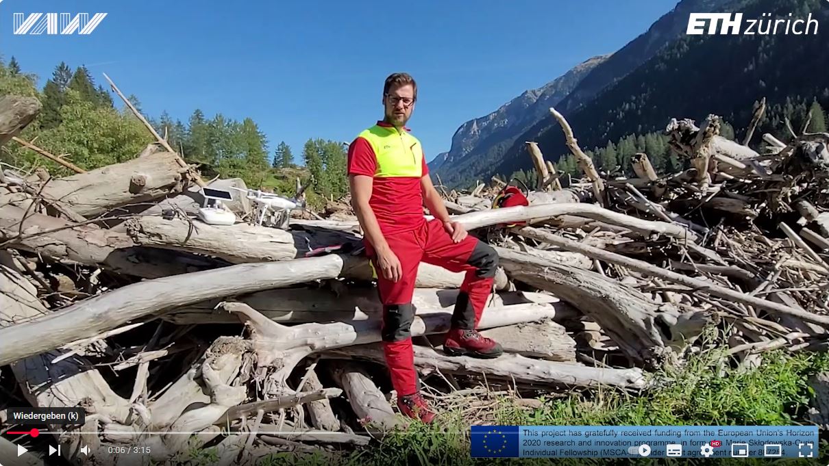
Dipl.-Ing. Gabriel Spreitzer, Ph.D.
Founder & CEO – Spreitzer Engineering Consulting (Civil & Environmental Engineering)
Zanitzberg 15, 8850 Metnitz, Austria · Tel. (+43) 0681 8113 1664 · office@ib-spreitzer.at
Expertise
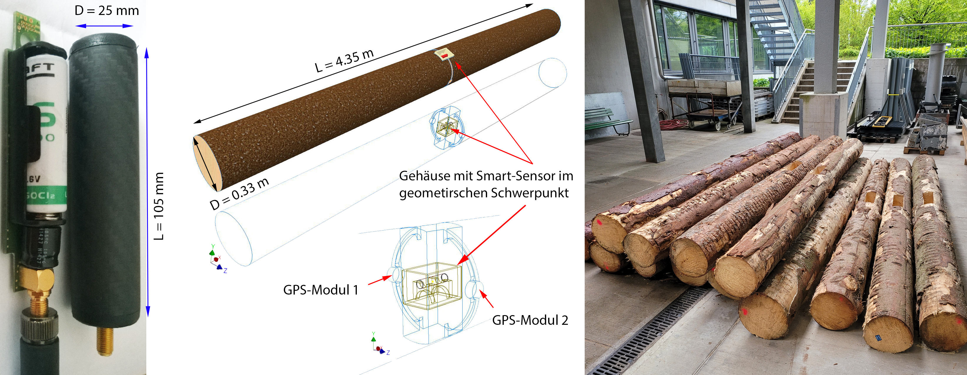
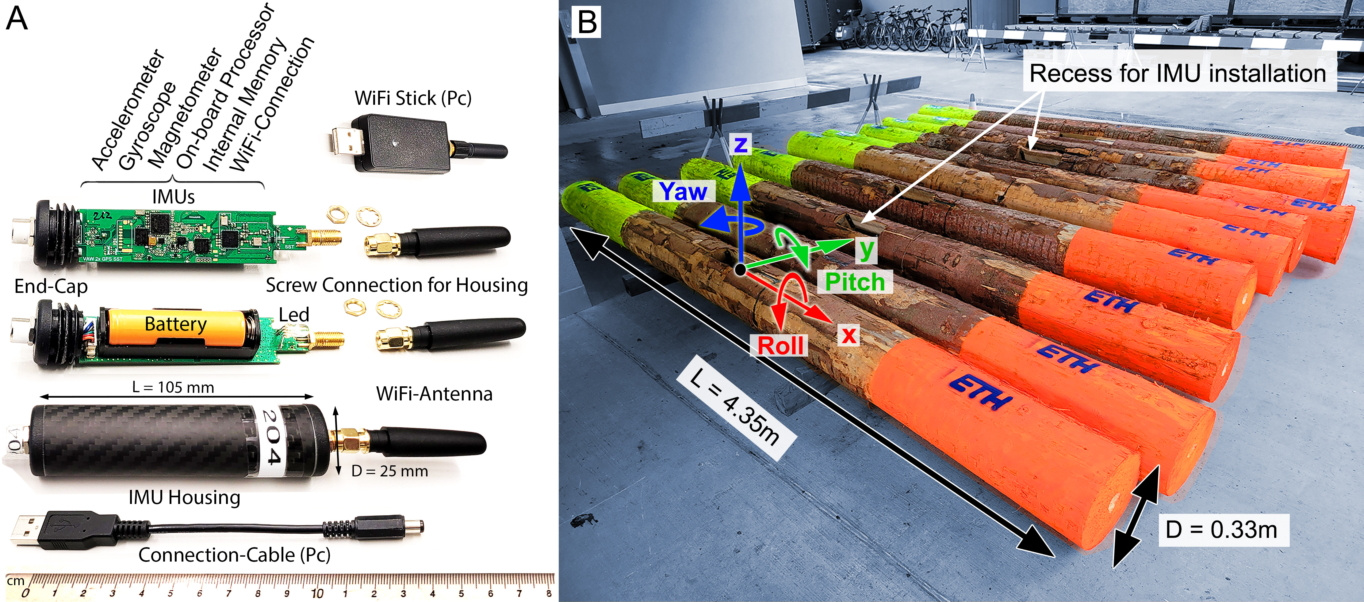
SmartWood_3D is the scientific foundation of our practice. Developed by Gabriel Spreitzer during his PhD and funded by the European Commission (EU-Horizon). From this, methods arise that enable a quantitative assessment of large wood risks, thus creating fact-based decision-making foundations for authorities and responsible parties.
Internationally established expertise
Dipl.-Ing. Gabriel Spreitzer, Ph.D. specializes in large wood and logjam dynamics in the context of flooding.
- Civil Engineer for Geotechnics and Hydraulics - Graz University of Technology (Austria)
- PhD at the University of Auckland (New Zealand)
- Postdoctorate at ETH Zurich (Switzerland)
- Marie Curie Award from the European Commission (EU-Horizon 2020)
His international research work focuses on the quantification of large wood transport, blockage mechanisms, and their hydraulic interactions with river engineering infrastructures. This scientific specialization forms the foundation of our practical work in the field of large wood risk and flood prevention.
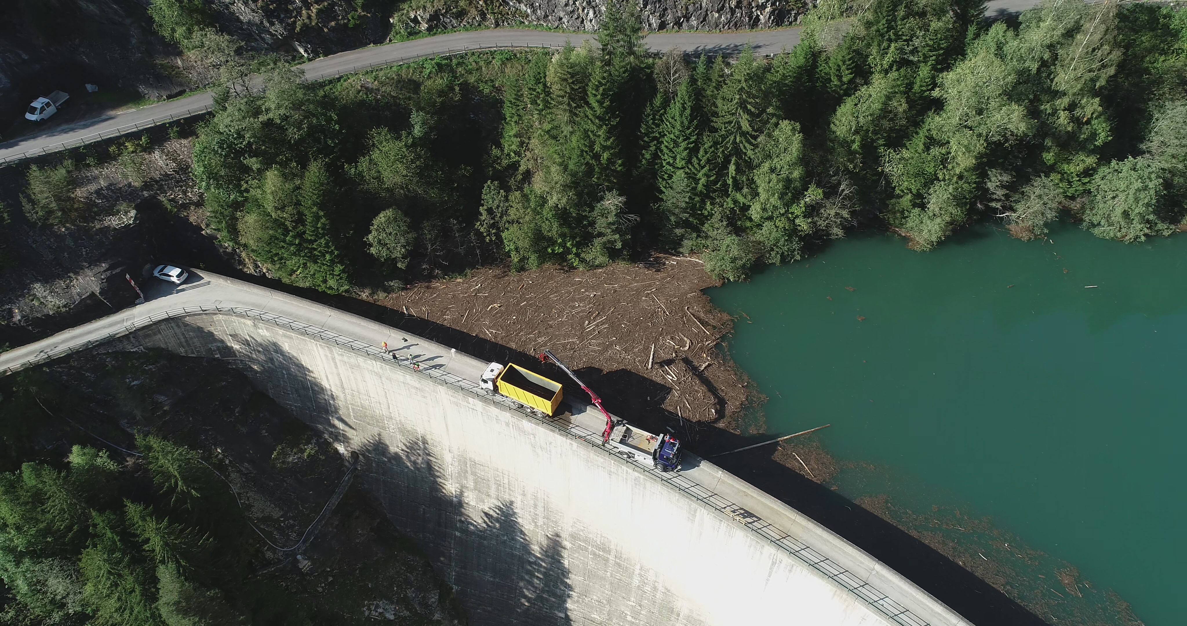
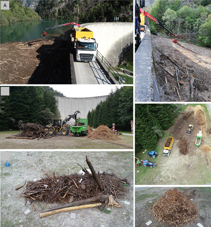
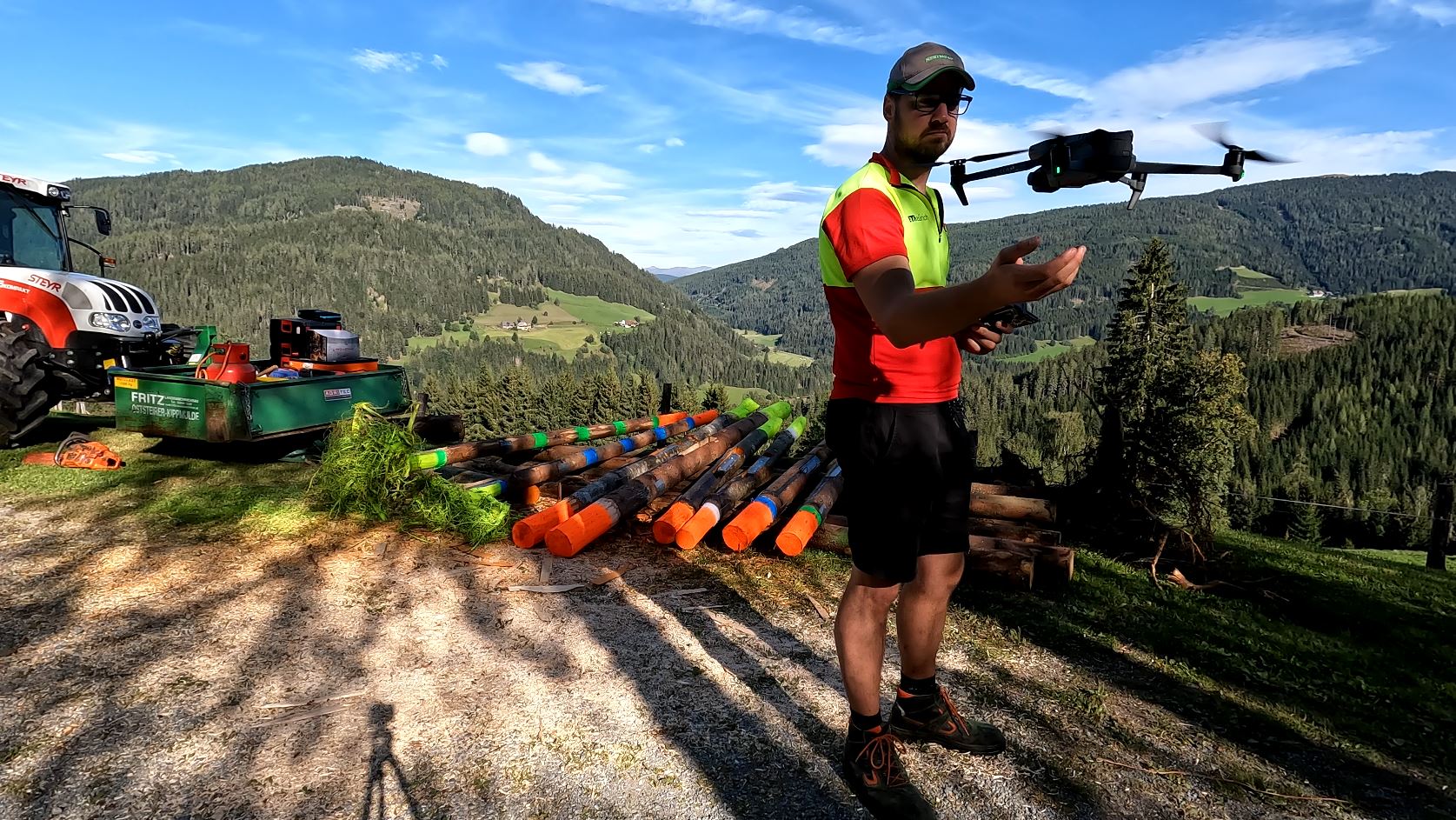
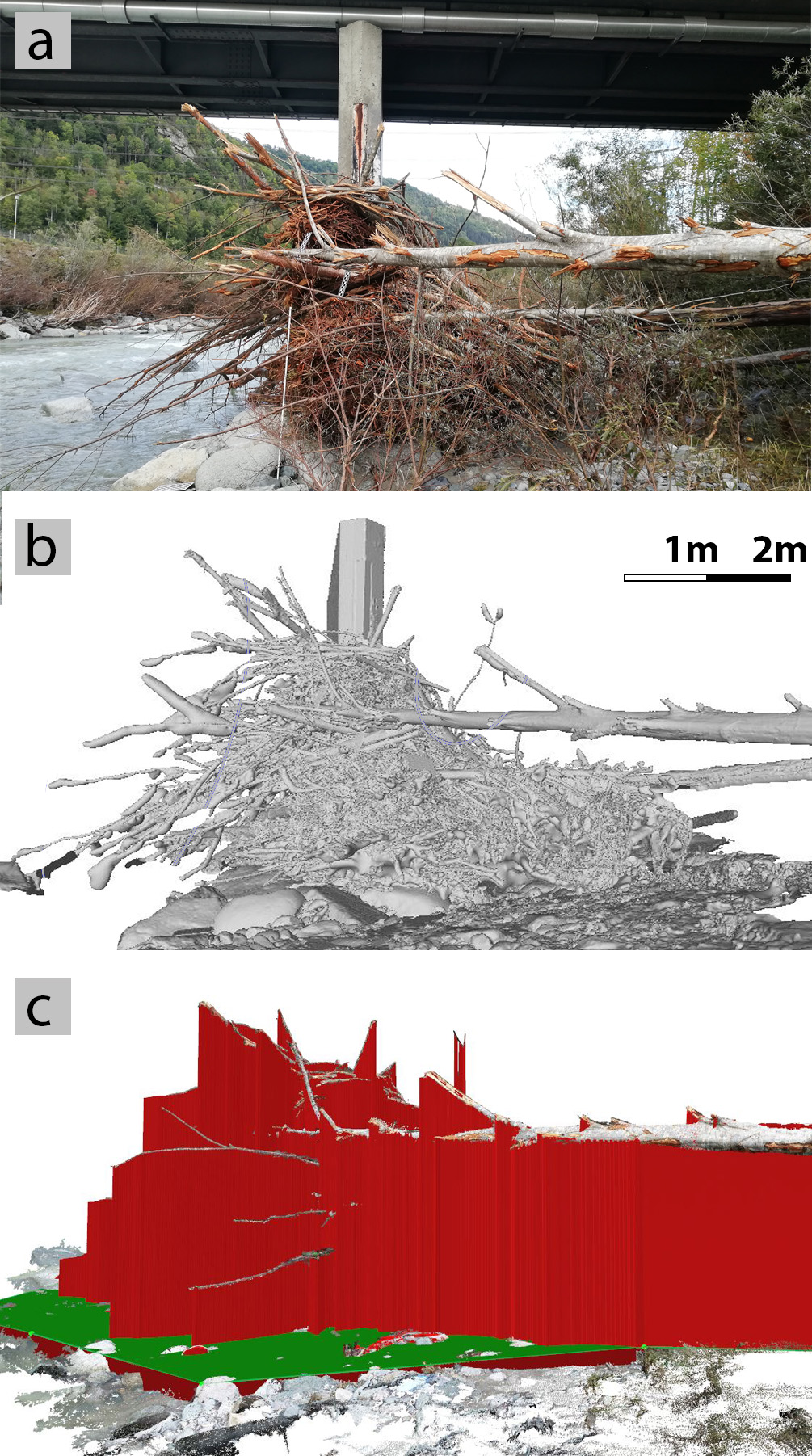
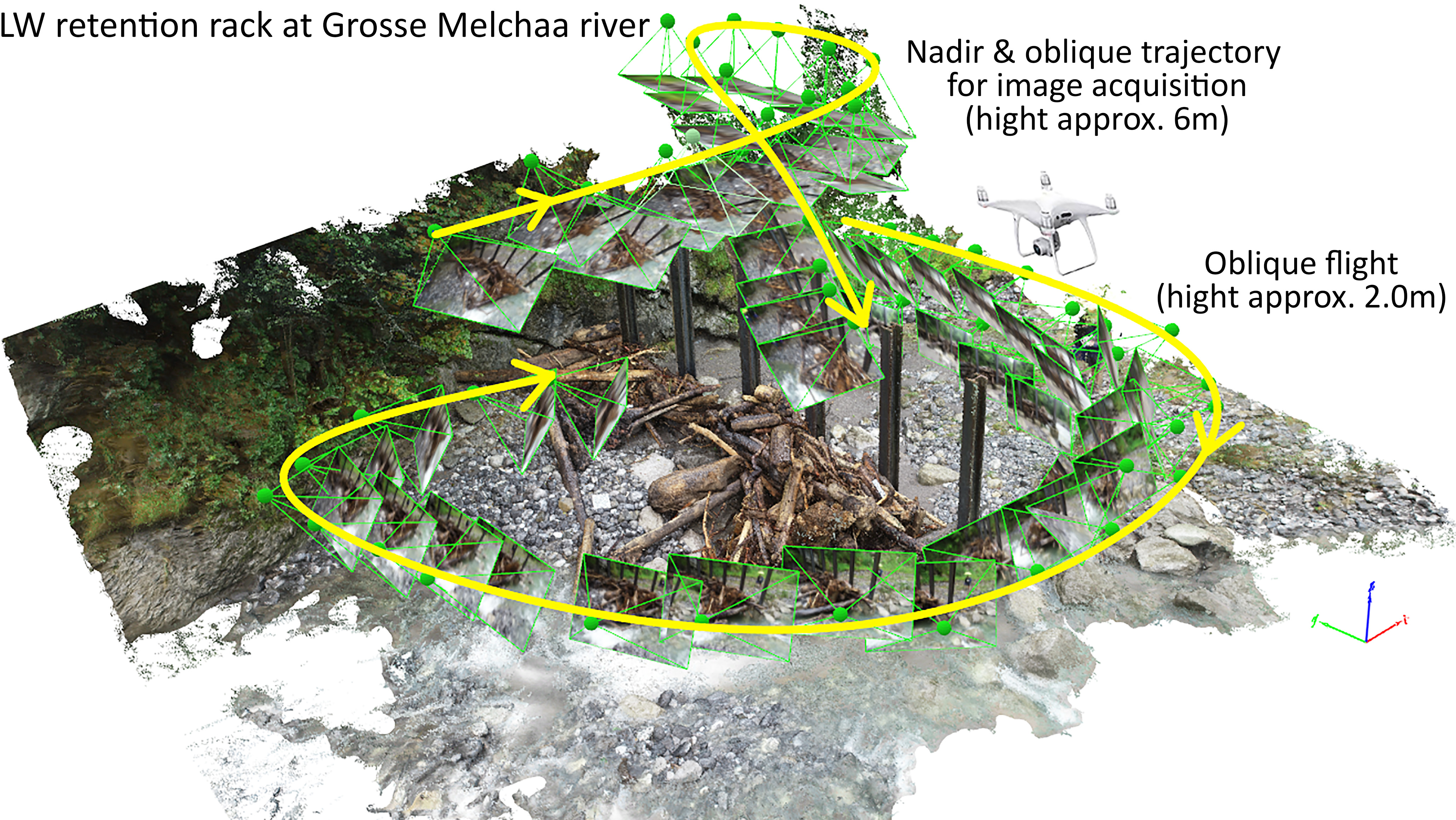
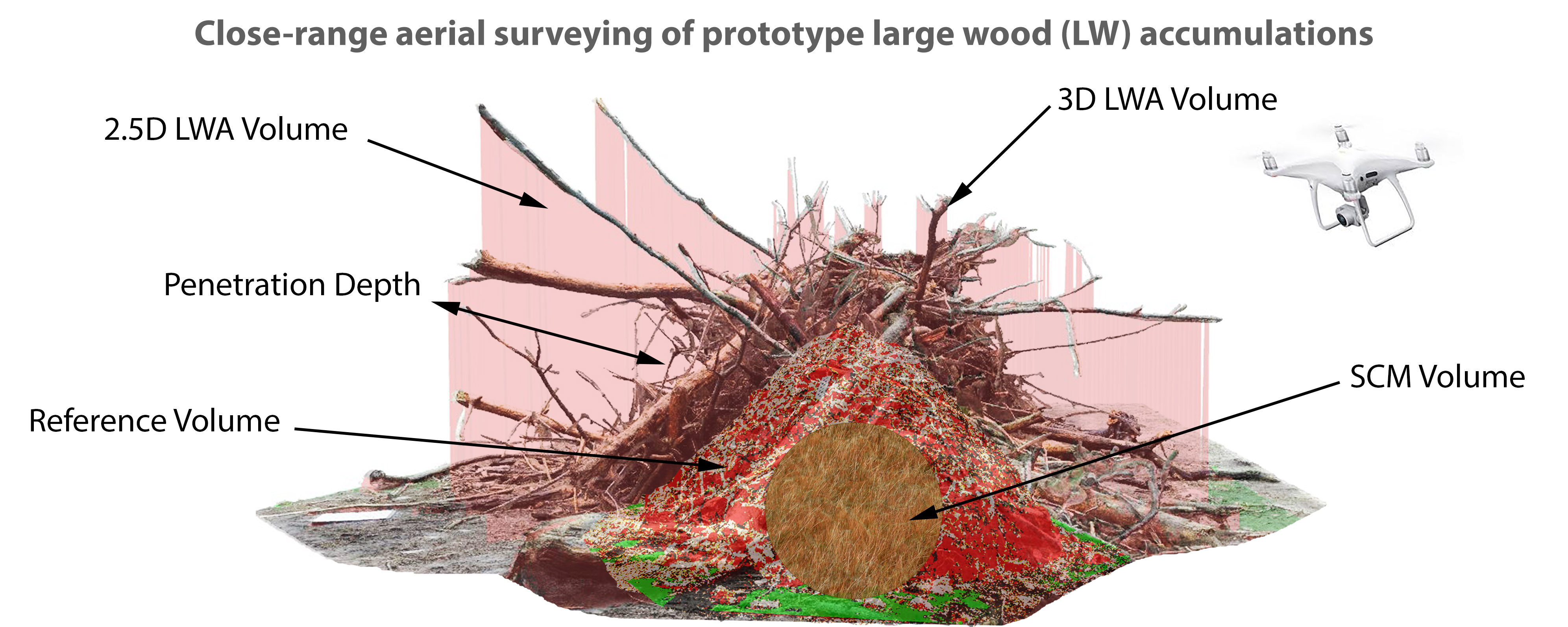
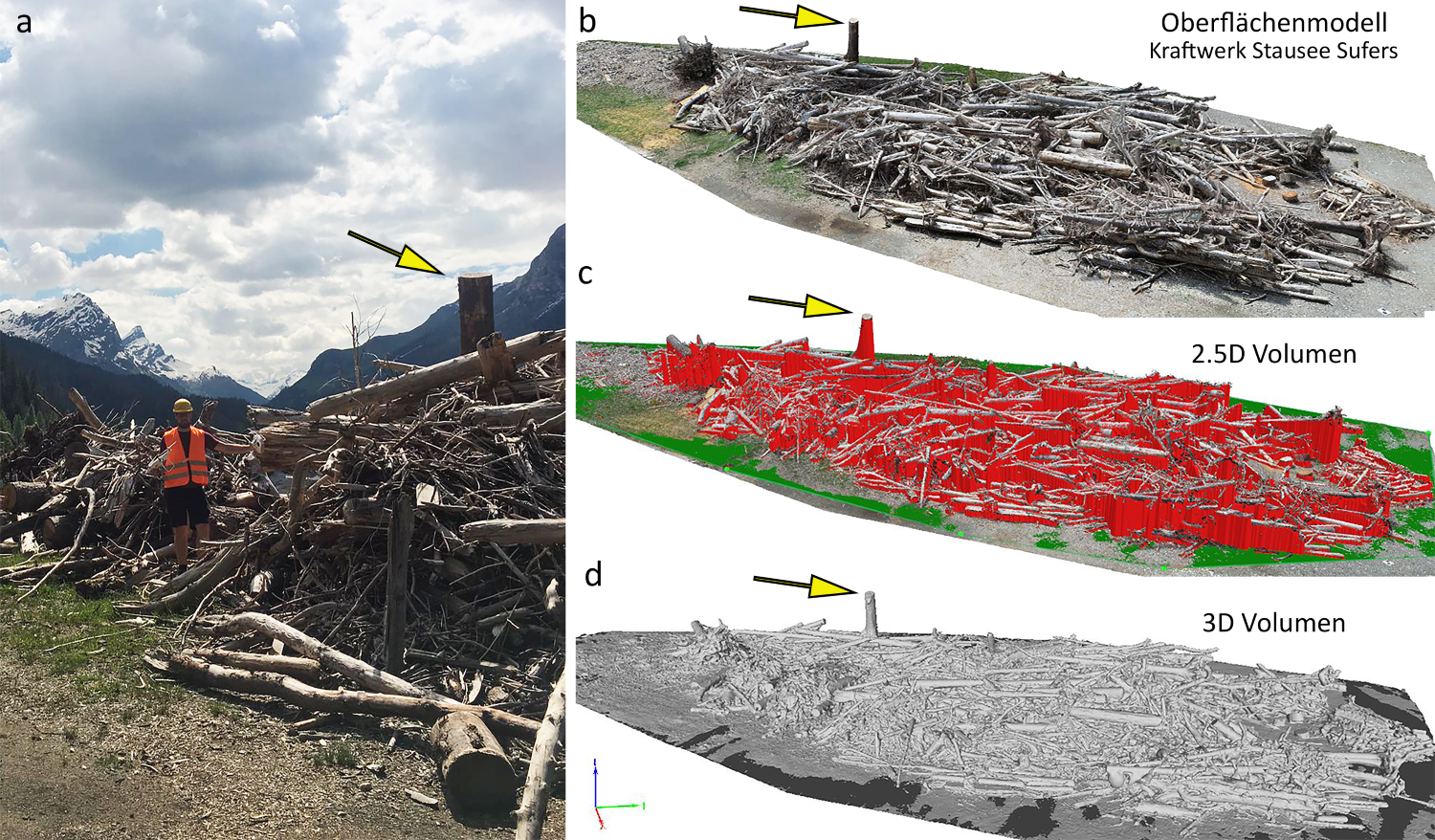
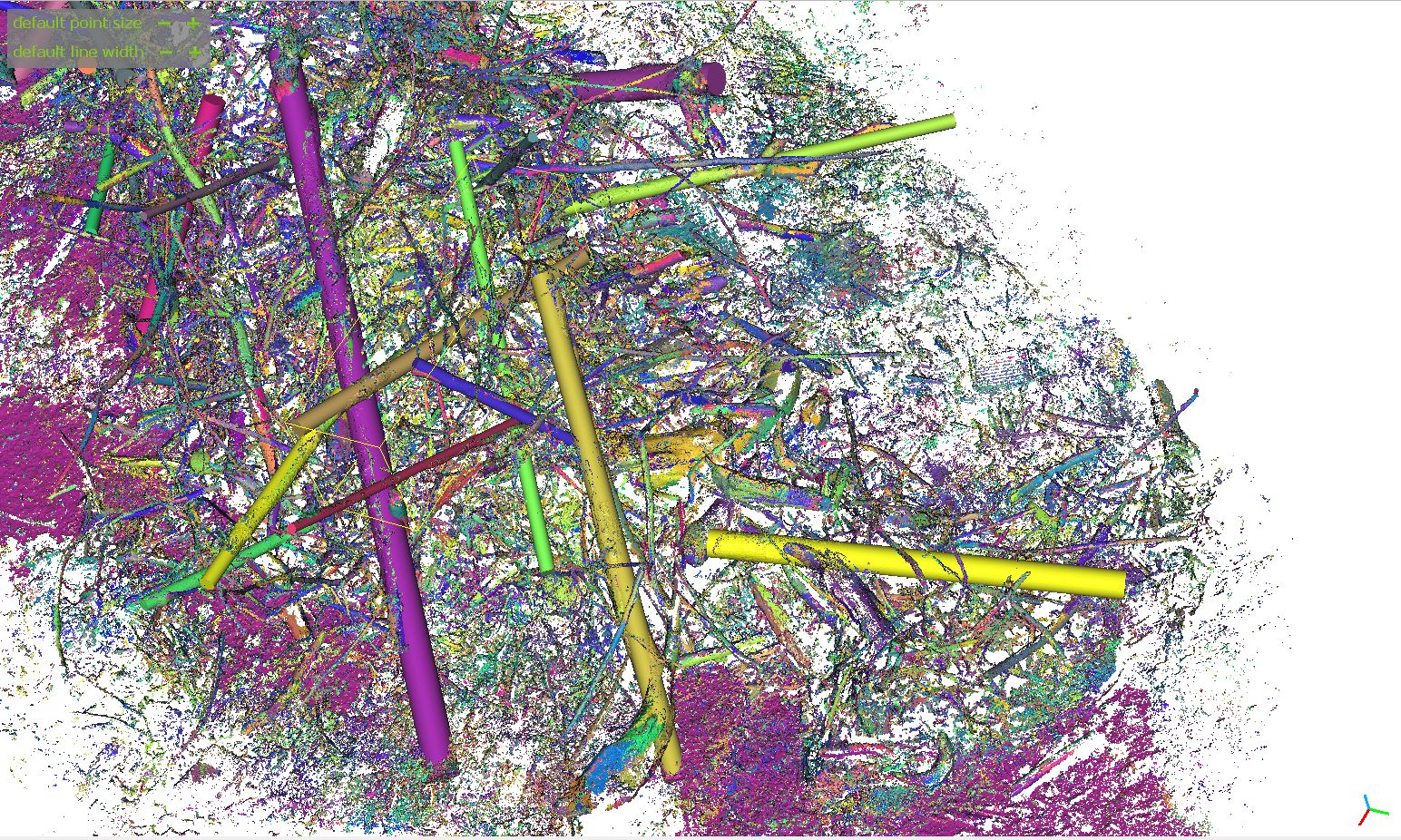
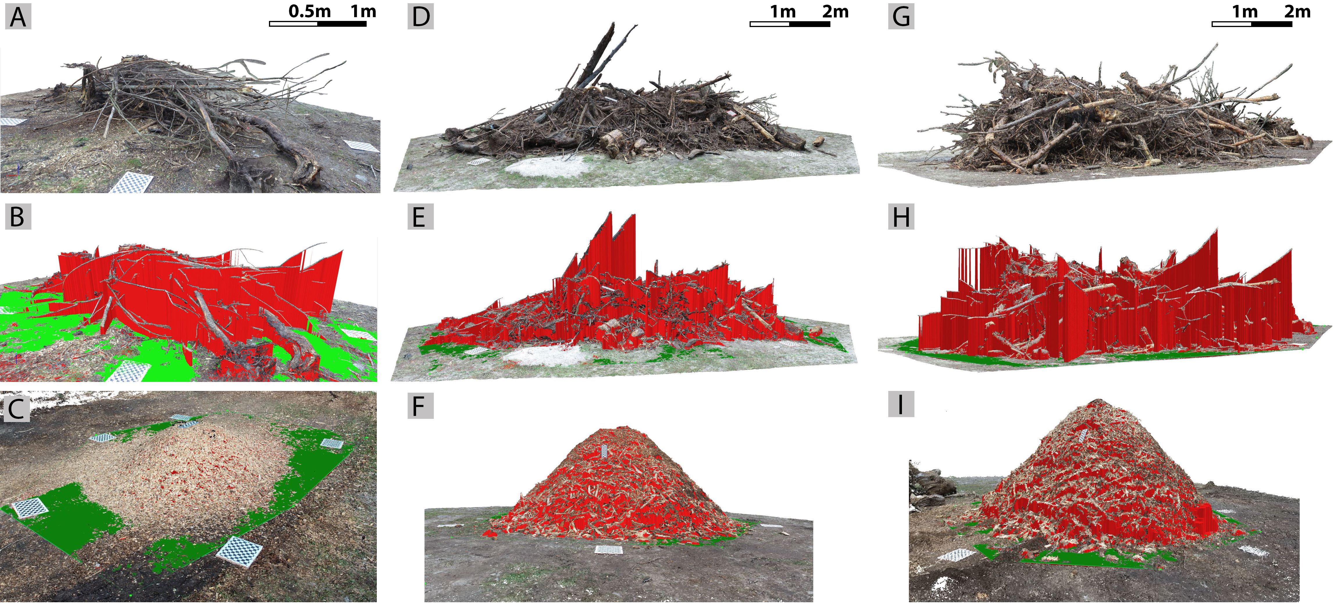
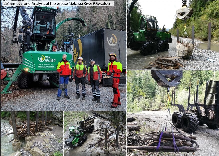
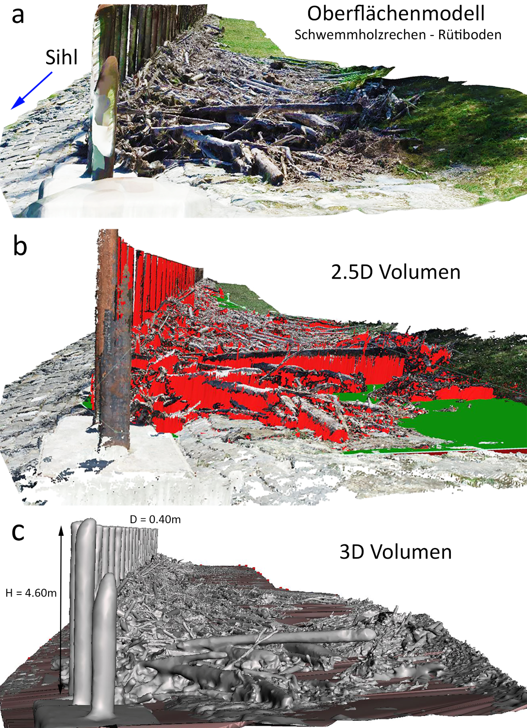
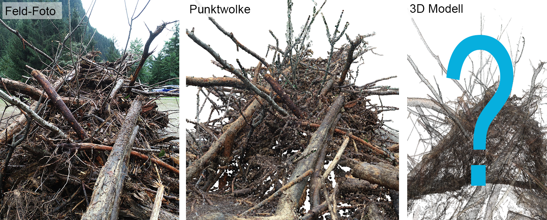
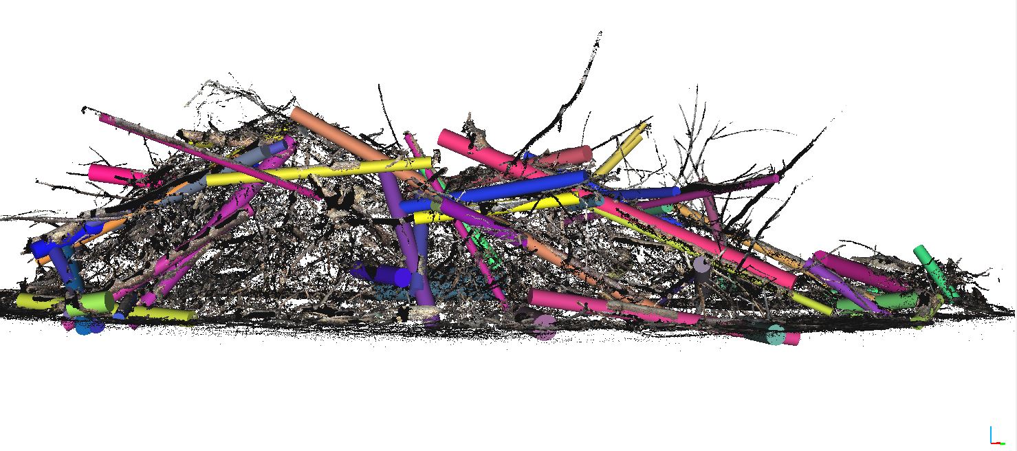
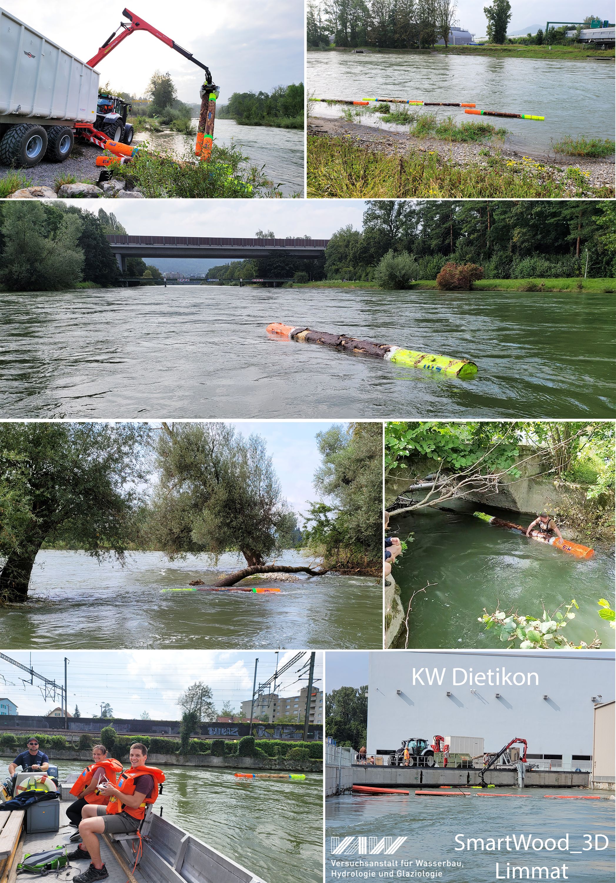
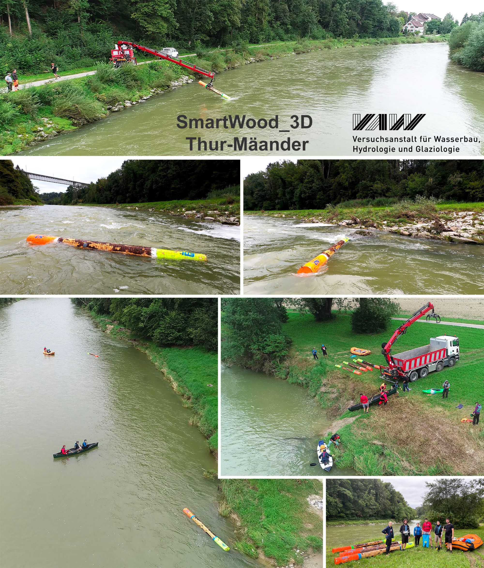
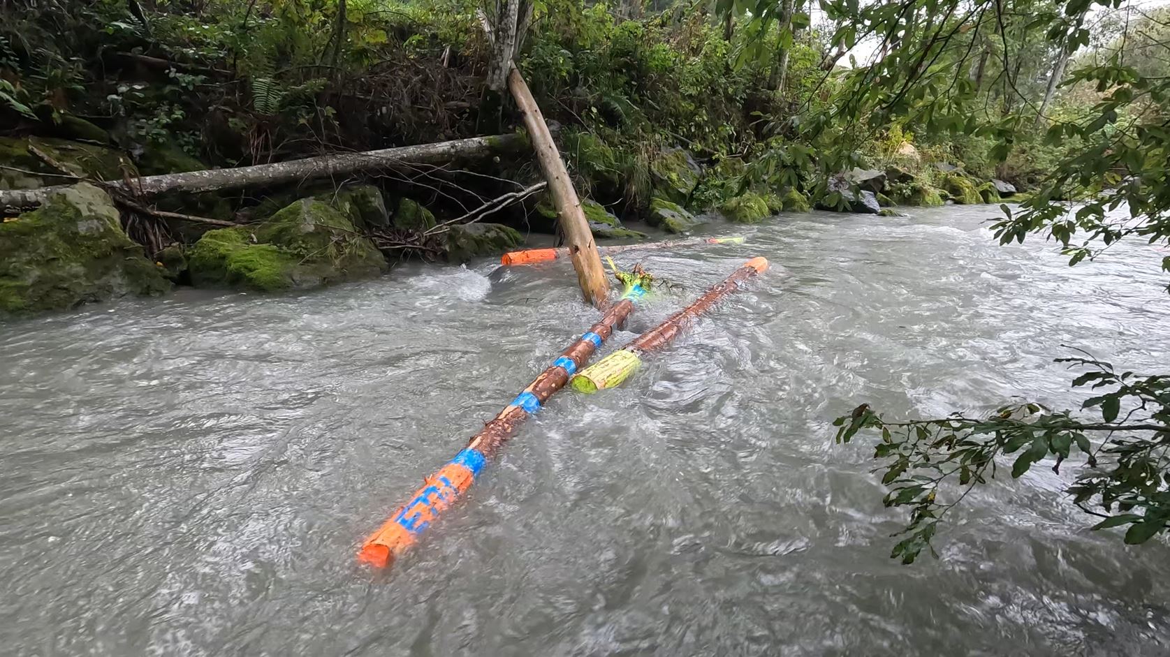
Photogrammetry & 3D Documentation
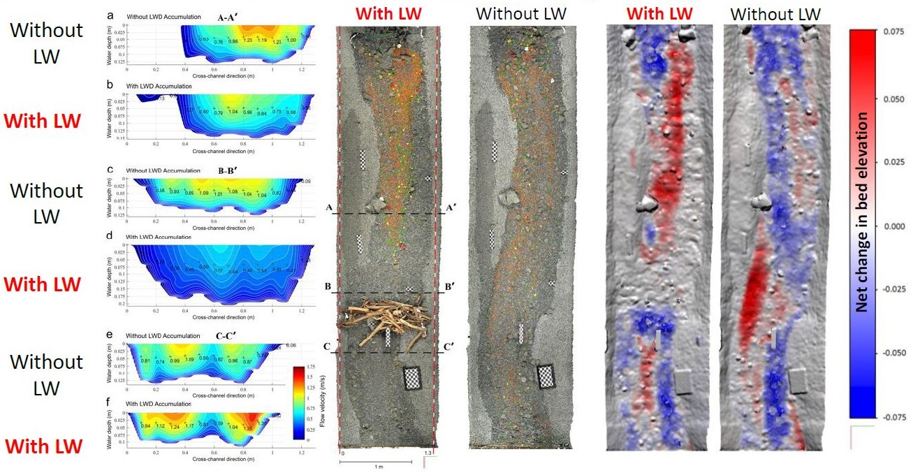
Complex large wood accumulations and blockages are captured, reconstructed, and analyzed three-dimensionally.
The developed methodology enables:
- volumetric quantification of blockages
- objective assessment of hydraulic relevance, e.g., calculation of logjam porosity (water permeability)
- recording of the structural arrangement of wood elements in the logjam ("Key-Logs")
- event documentation / traceable documentation before and after flood events
- robust decision-making foundation for planning and prioritization
translates visual observations into measurable data.
Decisions are thus not based on mere assumptions (estimates), but are built on quantitative data and structural analyses.
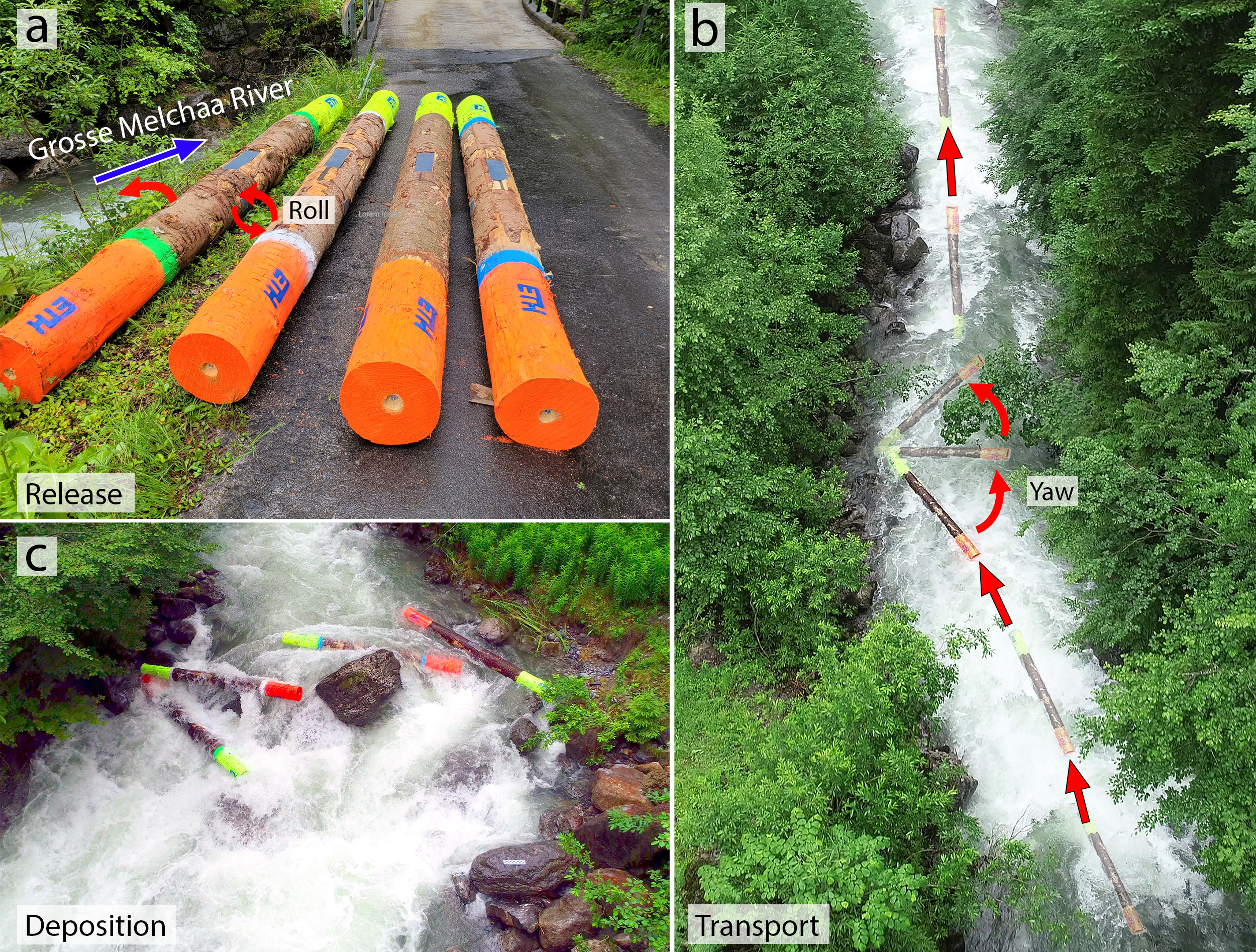
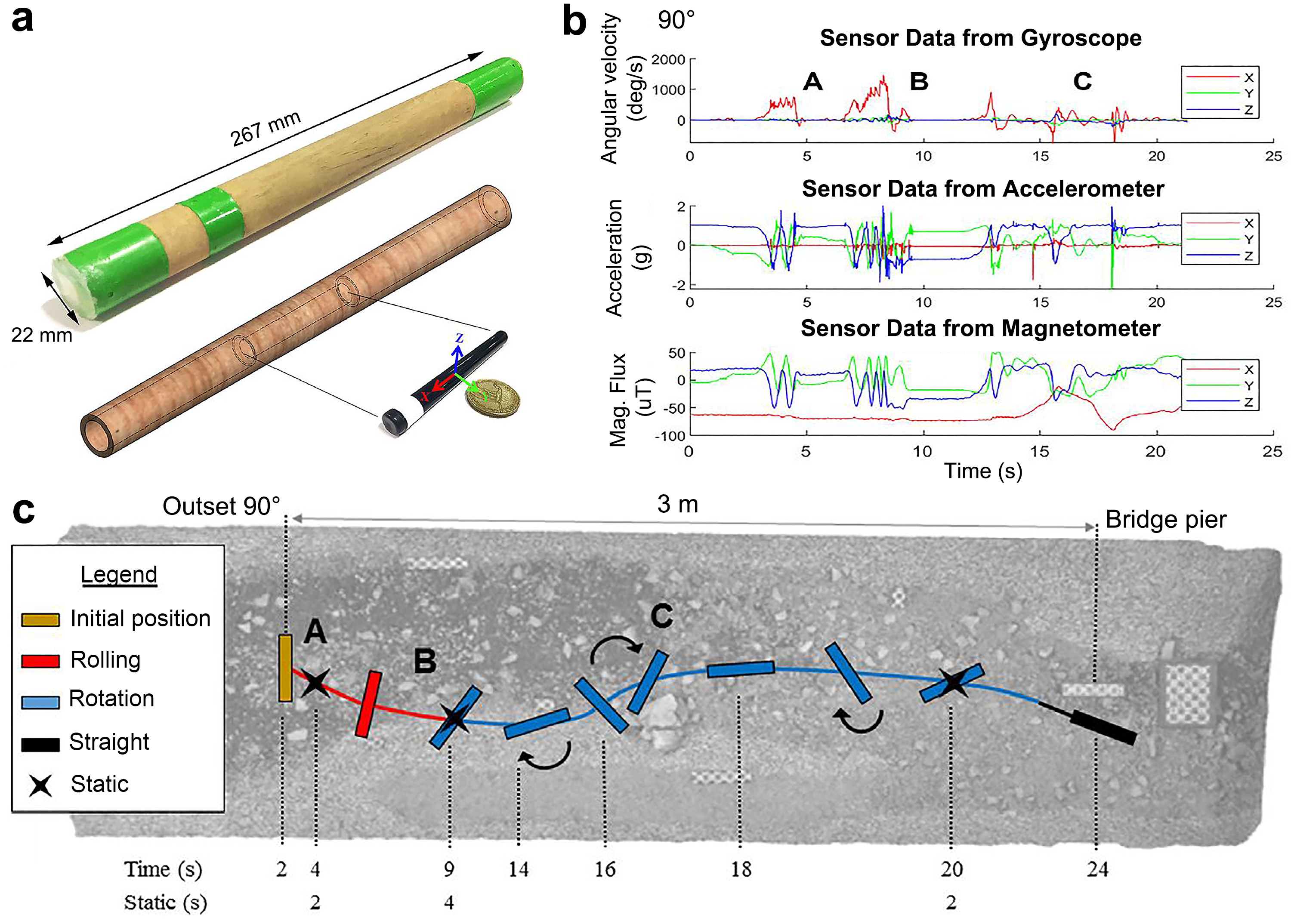
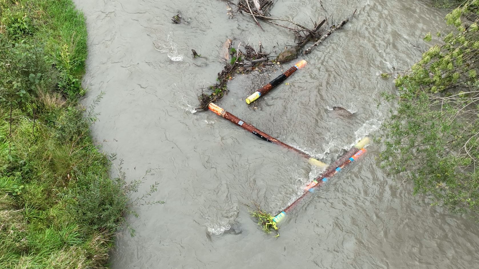
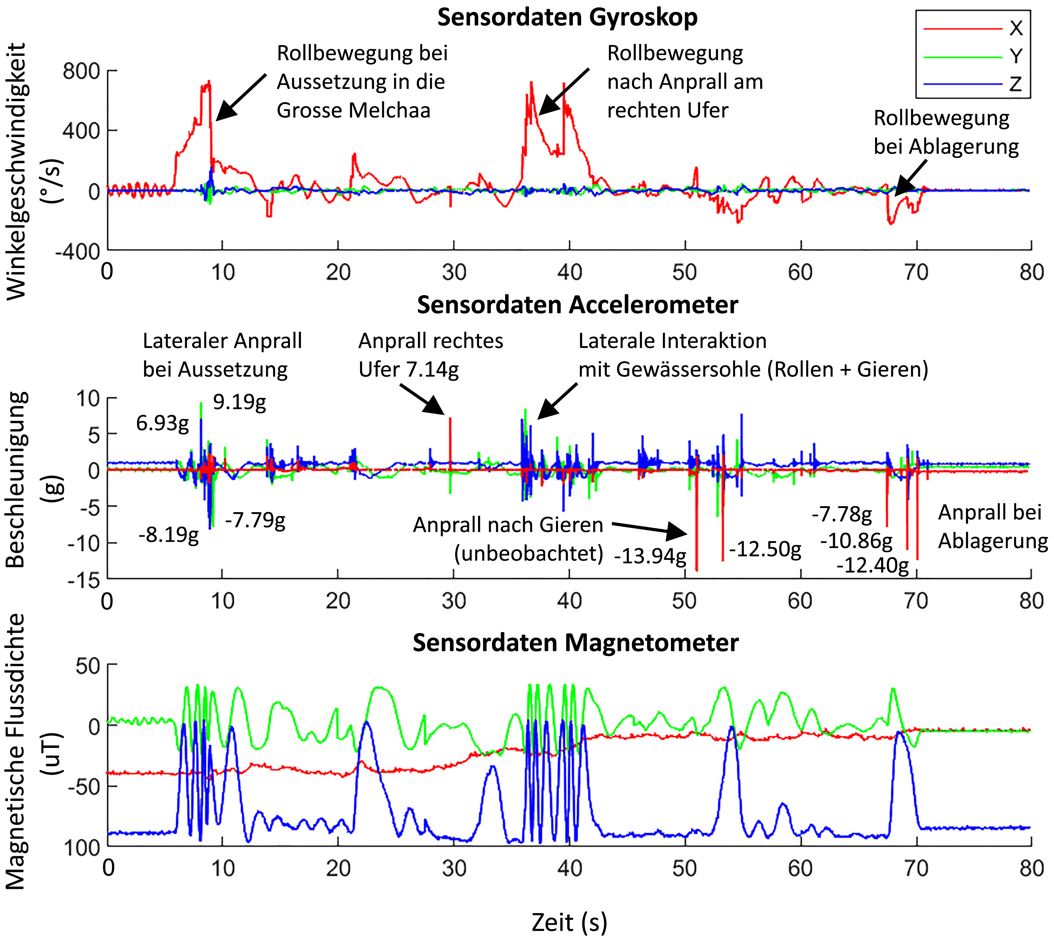
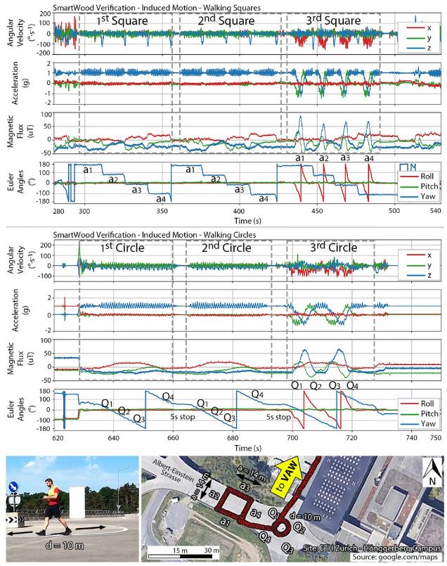
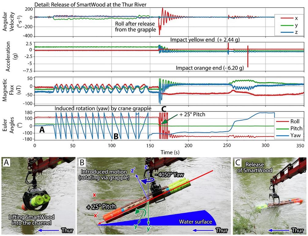
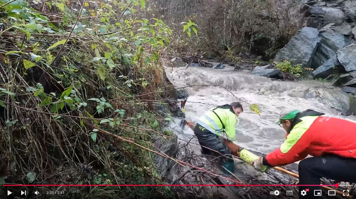
Sensor-based systems - SmartWood_3D (optional as early warning system)
Large wood transport follows clear dynamic patterns - physically determinable mobilization, transport, and deposition processes.
The decisive factor is their precise recording and an understanding of the processes in the event of a flood.
Sensor-based systems enable:
- the measurement (quantification) of mobilization and transport movements during floods
- the recording of impact forces of transported large wood on structures
- the analysis and reconstruction of movement paths and trajectories along critical watercourse sections
- the identification of preferred deposition and concentration zones
The acquired data provide robust insights into the actual dynamics within the system. This allows large wood streams to be specifically influenced and filtered out early before reaching critical bottlenecks.
At the same time, the sensor data form a sound basis for the proper dimensioning and positioning of retention and guiding structures. Measures are not applied across the board, but designed based on real transport dynamics.
Thus, observation and measurements turn into controllable and climate-adapted prevention.
From research to application
Our experience shows that transport dynamics are not random. Logjams are the result of specific transport and deposition processes and do not happen by chance.
They are the result of catchment area, discharge, transport dynamics, and structural constellation.
In the event of a flood, brief moments decide over backwater, flooding, and structural overload.
Unevaluated large wood risks belong to the frequently underestimated damage amplifiers in water systems during flood events.
A profound understanding of large wood transport dynamics is crucial for the targeted design of retention structures and the avoidance of uncontrolled deposits. We create clear decision-making foundations for:
- the selection of technically effective and economically, as well as ecologically, justifiable measures indicating which sites/structures are critical
- prioritized securing (where there is a real need for action)
- the proper dimensioning and positioning of retention and guiding structures
- the identification of preferred deposition and concentration zones
- the evaluation of existing infrastructure regarding susceptibility to logjams
- the optimization of operation, maintenance, and monitoring strategies
- transparent communication towards authorities, operators, funding agencies, and landowners
The transition from research to practical application takes place systematically: Scientific models are validated with real measurement data, event analysis is transformed into planning parameters, and theoretical findings are translated into implementable engineering decisions.
Scientific depth is thus converted into concrete, actionable strategies.
Services
Engineering Office (Consulting Engineers) – Field of Civil & Environmental Engineering.
Focus: Large wood and flood prevention based on clear, robust decision-making foundations.
We support authorities, infrastructure operators, professional associations, and private landowners in evaluating the expected large wood load and the risk of blockage during floods, and help in the development of tailor-made prevention and protection concepts.
Concept & Detail Studies
Sound concept and detail studies as a reliable basis for prioritization, investment decisions, and long-term, climate-adapted flood security.
Risk Analysis & Measure Planning
Systematic assessment of large wood and flood risks; from the upper catchment area to critical infrastructure.
Derivation of technically effective and economically viable protection measures.
Large Wood Potential Analysis & Blockage Evaluation
Identification of critical bottlenecks and assessment of real blockage risks at bridges, culverts, river engineering infrastructure, and transverse structures.
Clear decision-making basis for communities and operators of safety-relevant infrastructure.
Documentation, Monitoring & Event Analysis
Objective documentation before and after flood events, 3D analysis, as well as structured evaluation and processing of events.
Transparent evidence for planning security, optimization, and liability relevance.
Decentralized Retention & Catchment Area Concepts
Development of effective strategies for retention and infiltration right where the flood originates.
Holistic approach from the micro-scale to the main watercourse.
Additional Services
Processing of all tasks in civil engineering and water management – from planning and assessment to technical support and expert reports.
References
Selected focus areas and research practice – curated, traceable, suitable for authorities.
Publications
Links open externally.
Contact
Feel free to reach out to us via email or directly by phone.